
Ennerdale Water
Ennerdale Water is the most westerly lake of the Lake District and one of the most remote of the lakes in the Lakes District.
As such Ennerdale is not as well known to tourists who tend to head towards the central lakes like Derwentwater and Windermere. Along with Wastwater and Wasdale, Ennerdale Water is another lake that is local to my home and I have visited the lake on many occasions. The valley and lake are a Site of Special Scientific Interest.
In 2002, a plan was hatched between landowners to let their land run wild and the following year the plot became a project, Wild Ennerdale. The Forestry Commission, the National Trust and United Utilities – which together own the Ennerdale valley – agreed to “allow the evolution of Ennerdale as a wild valley, relying more on natural processes to shape its ecology and landscape of the area”

Ennerdale Water from the weir at Bleach Green
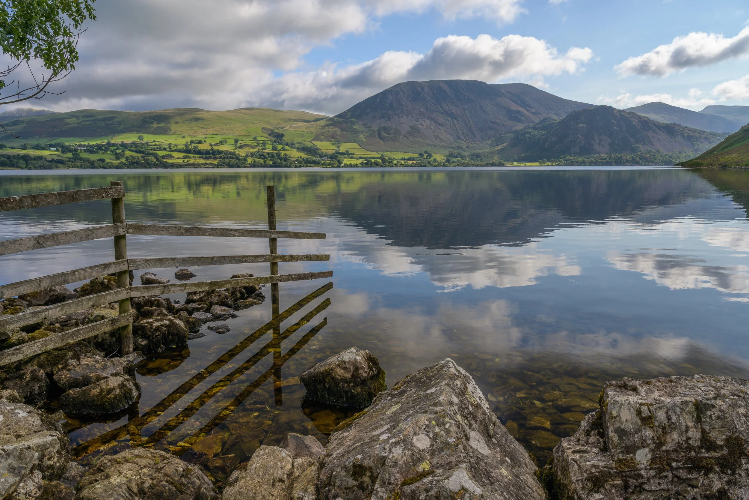
With road access limited to its western end, and only three buildings in five miles, Ennerdale was already wilder than most places in the Lake District. The valley, is seven miles long, from the village of Ennerdale Bridge to the mountains of Green Gable and Great Gable at its head, and about two miles wide from peak to peak. The valley floor is dominated by the two-mile-long lake of Ennerdale Water fed by the River Liza.
Access to the lake is via the A5086 road between Cockermouth and Egremont and the turn off for the lake is signposted. The village of Ennerdale Bridge marks the start of the access road itself, which becomes a narrow winding mainly single track road with passing places. There are two car parks available from this road, Bleach Green near Broadmoor forest at the beginning of the lake, and Bowness Knott at the end of the road.
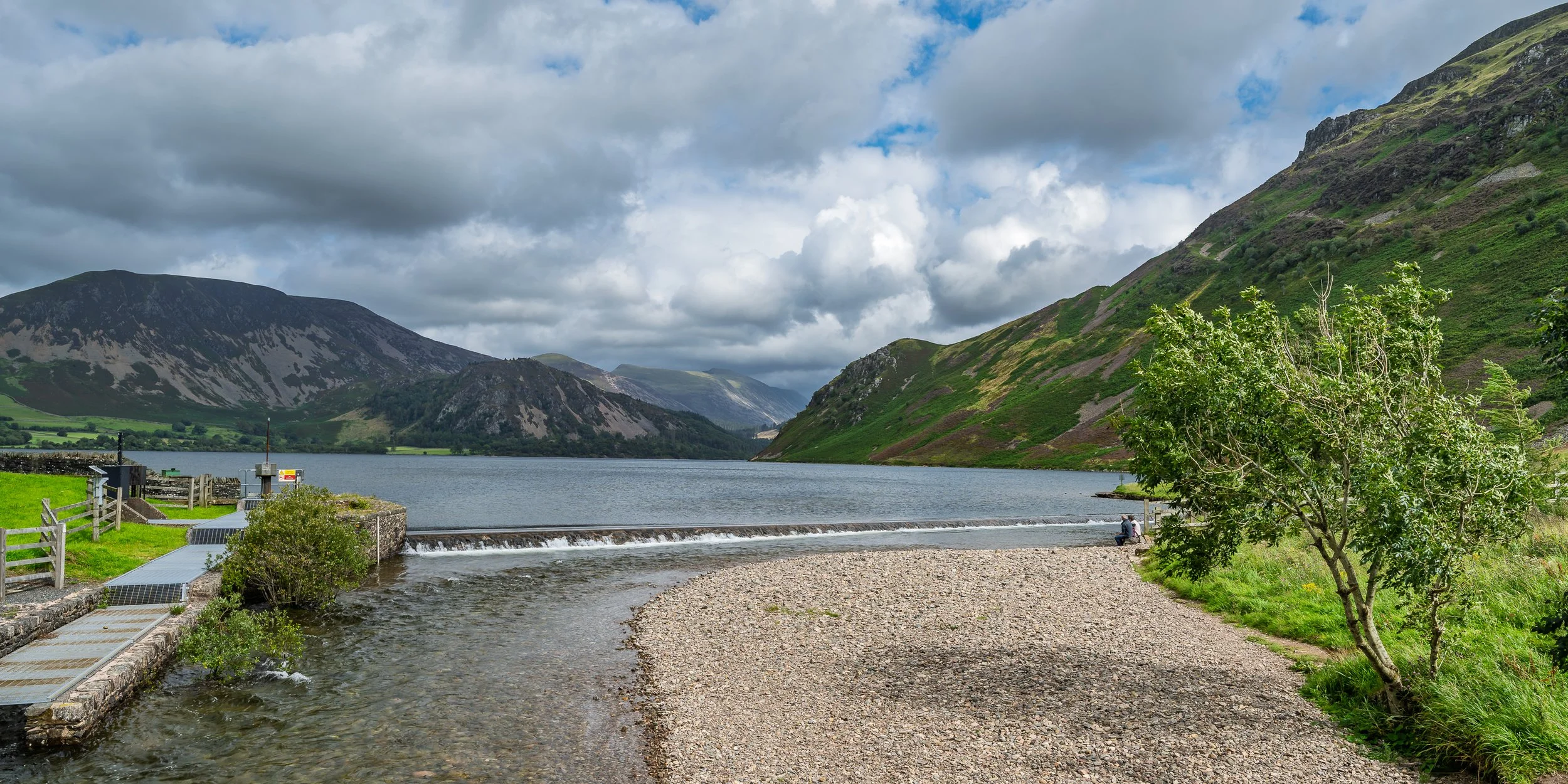
The weir at Bleach Green flowing into the River Ehen
It is possible to walk around the entire lake by starting at either of the two car parks and following the path that generally sticks to the shore. This walk is around 6.5 miles in length and most of it is along a fairly flat path, although on the southwest side of the lake around Anglers Crag you may need to do a small amount of scrambling. I started the walk from Bleach Green Car Park as the parking is currently free whereas Bowness Knott has recently introduced a pay and display system (although the pay machine is often not working). From the car park head out of the back on the track towards the lake. This takes you to the weir, feeding overflow water into the River Ehen. You can walk either direction around the lake but I chose clockwise, so crossed the metal bridge over the River Ehen and through the wooded area.
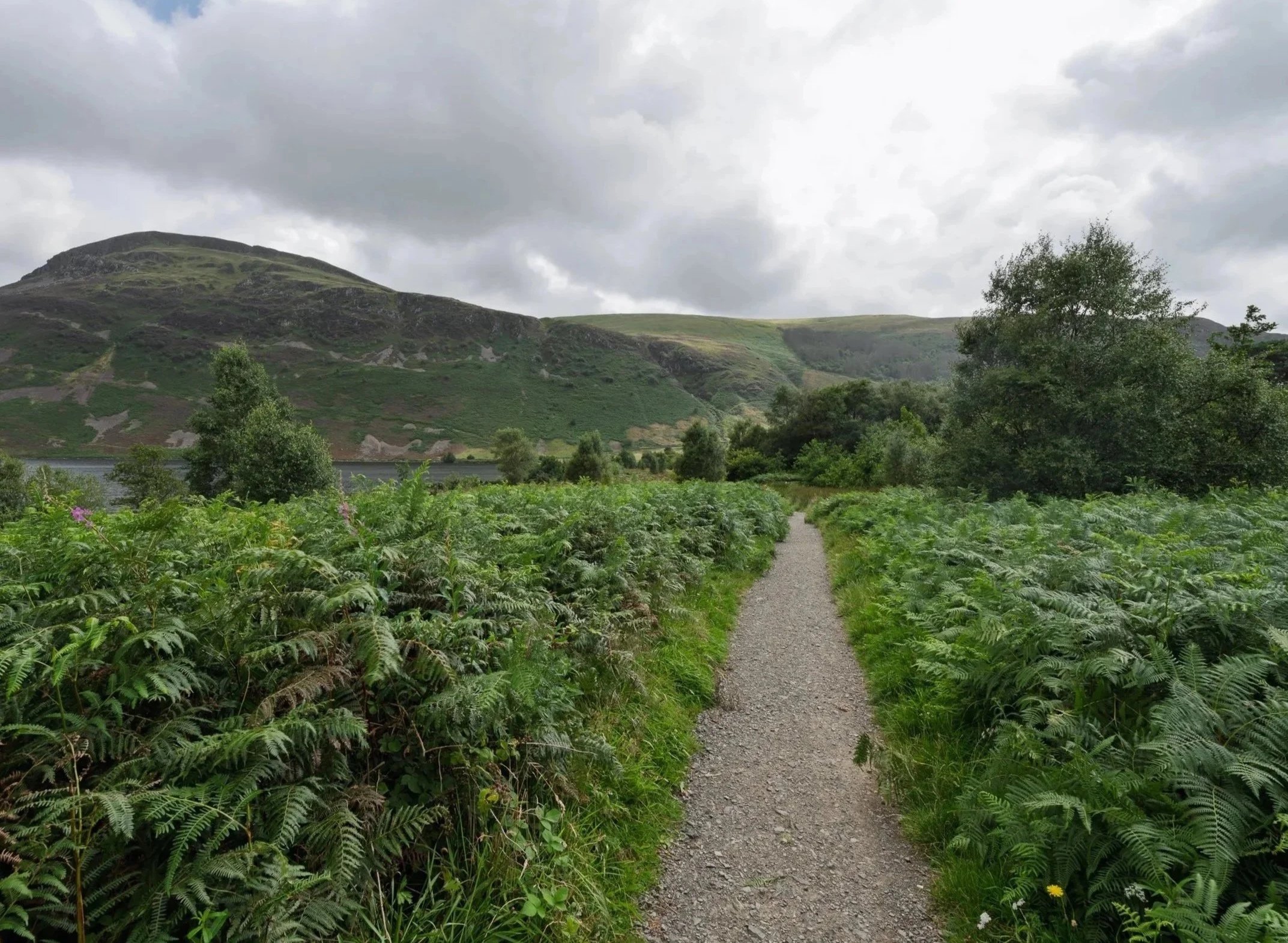
Looking back along the path from Bleach Green towards the lake

Ennerdale Water in the mist
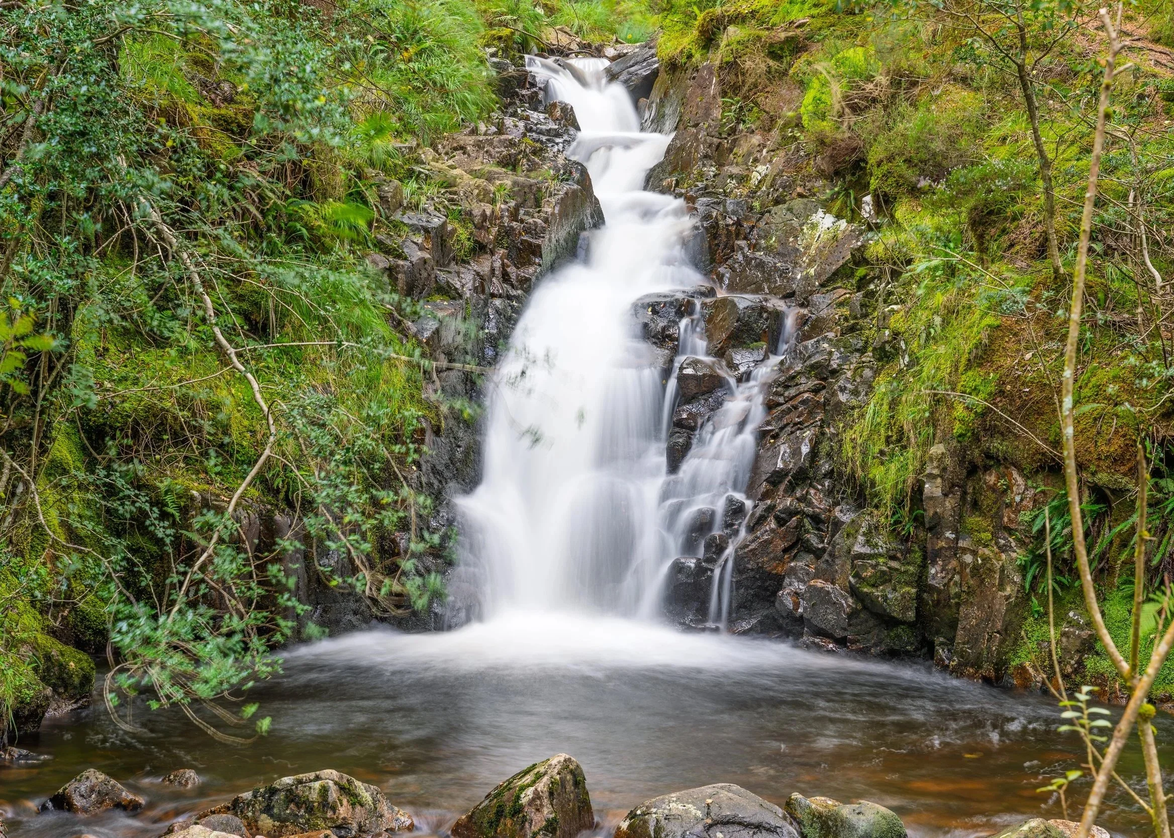
The path quickly reaches the lake shore and never really moves far from it until you reach Bowness Knott. There are several benches and beach areas where you can sit and view the lake. Early mornings with mist over the water can be particularly photogenic. At Bowness Knott the path rises steeply but it is short and tarmac and you soon reach the car park. Follow the compacted forestry track from the carp park back down towards the lake shore once more. The track follows the north eastern side of the lake where you will find the start of the Wild Ennerdale valley, a project that aims to restore a truly natural landscape to the area, devoid of any interference from humans. A detour from the main track allows you to walk through the wooded area is a great way of exploring nature and if you are lucky you may spot deer or squirrels. The forest path also takes you past two small waterfalls that look quite impressive after heavy rain.

Waterfalls along the Wild Ennerdale Forest Trail

Ennerdale Water from the Forestry Commission track around the lake
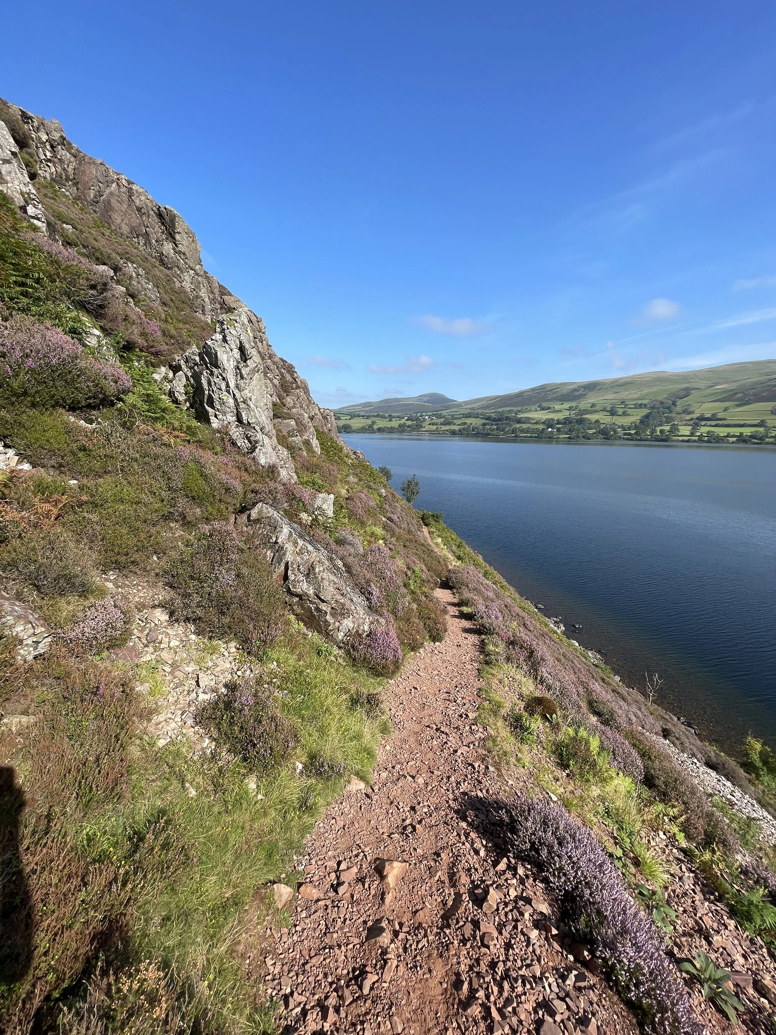
After returning to the main track continue until you come to a concrete bridge on your right hand side and cross the bridge over the River Liza and follow the path through the farmland until you reach the gate. (The main track continues towards the Ennerdale and Black Sail Youth Hostels). There are some great views along the valley to the fells on your left or back along the lake on your right. Take the smaller gate to the right of the main gate and follow the path across the field towards the lake. There are often cattle in the field so take care during calving especially if you are walking with dogs, and don’t walk between the cows and their calves. Pass through the small wooden gate and onto the path. From here the path becomes very rocky and waterlogged as run off from the hills joins the lake. Although rocky the path is fairly flat, following the lake shore along most of its length until you reach Angler’s Crag.
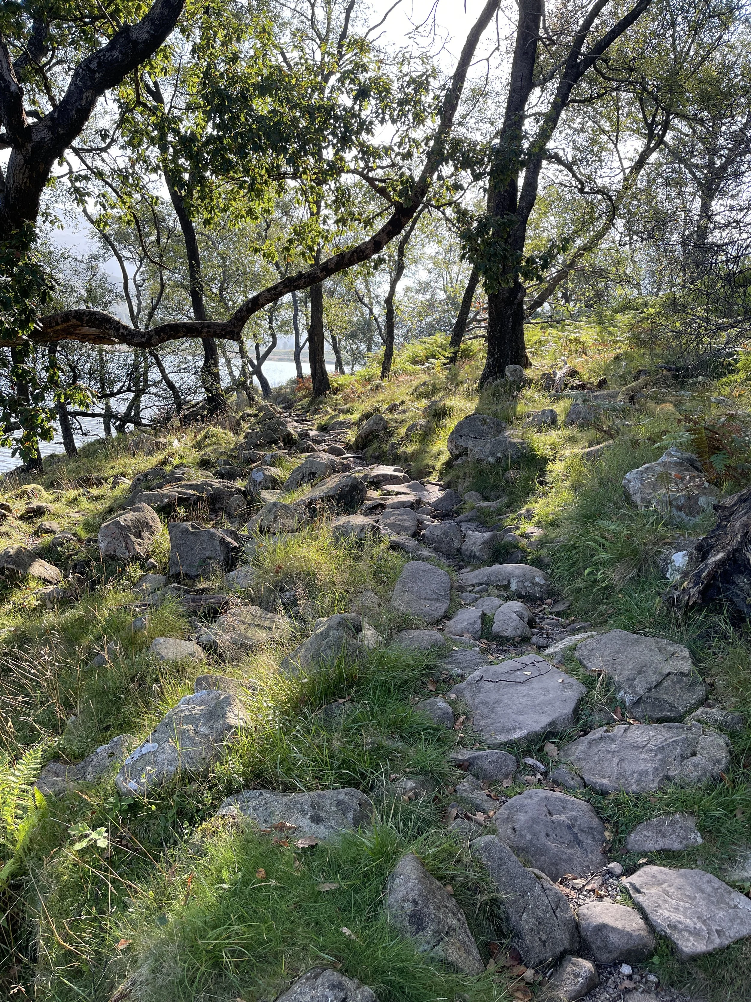
The path down the South Western side of the lake becomes very rocky
Climbing up towards Angler’s Crag
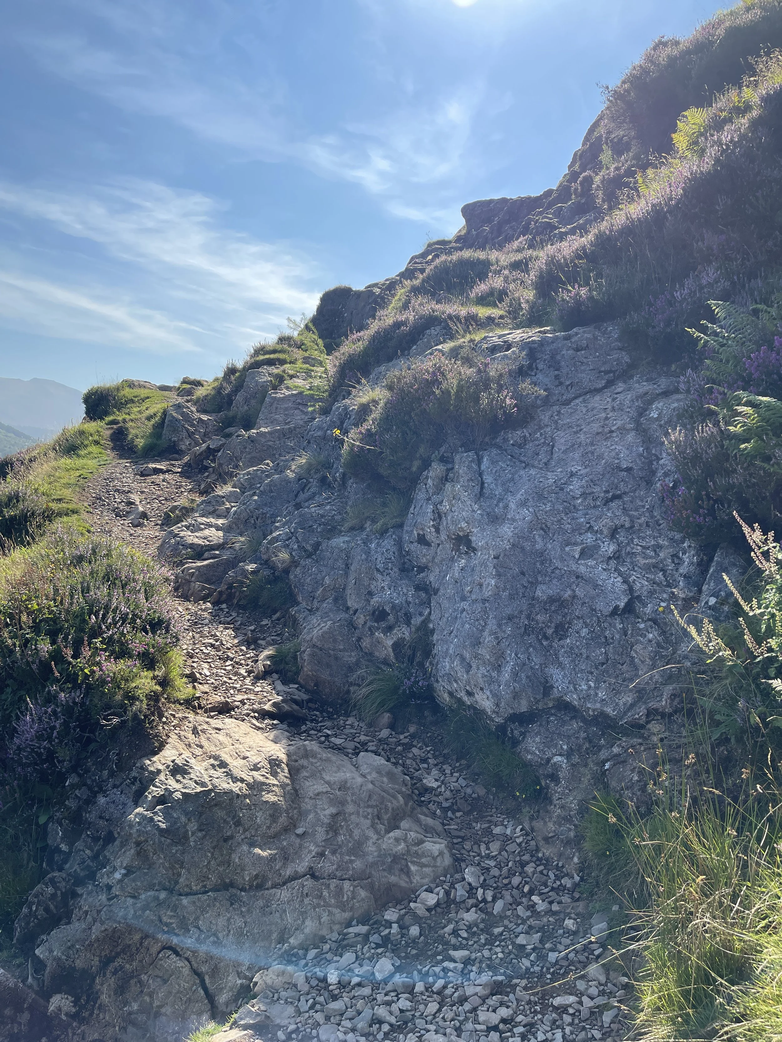
The path rises quite steeply up a scree covered surface that can sometime be unstable before reaching Angler’s Crag and Robin Hood’s Chair. This is a particularly rocky outcrop that you have to scramble over. It’s easier to keep away from the edge and go higher as the drop is fairly significant and sheer. There is then a steep descent down the rock face back to the path. If it’s not busy, it is well worth spending a little time sitting on Robin Hood’s Chair taking in the views along the lake.
After the scramble down from Robin Hood’s Chair the path returns to the lake shore and continues to follow the lake back to the car park at Bleach Green. All in all its an easy relaxing walk around the lake except for the short scramble at Angler’s Crag.
The scramble up and over Robin Hood’s Chair
View of Ennerdale Water on the path as we return to Bleach Green.
Getting There:
The lake can only be accessed from the west. Ennerdale Bridge is accessed from the A5086 between Cockermouth and Egremont. Once at Ennerdale Bridge, turn down beside the small school and follow the road for approximately ½ a mile until you see a signpost to the right for Broadmoor and Ennerdale Lake. Turn off and follow this road for a further ½ mile through the forest until you arrive at the car park.
Broadmoor / Bleach Green Car Park: Grid Ref NY 085 154
For Bowness Knott car park follow the same route but continue past the Broadmoor turning for a further 4 miles until you arrive at the car park in the woods at the base of Bowness Knott.
Bowness Knott Car Park: Grid Ref NY 109 153